
Published on 03/October/2026 · Nature
A continent of butterflies, a small forest at the end
By SORAH Editorial
Eastern monarchs connect a vast summer range with mountain forests in central Mexico. A seasonal map brings the scale of that journey into view.
Eastern monarchs connect a vast summer range with mountain forests in central Mexico. A seasonal map brings the scale of that journey into view.
A butterfly visiting a garden can belong to a story that extends across national borders. Monarchs migrate from Canada and the United States toward wintering sites. Eastern populations head toward the mountains of central Mexico; western populations have a different geography, including wintering groves along the California coast. This map follows the eastern autumn migration.[2][5]
![August in a seasonal model. Particles are illustrative locations, not measured abundance or an observed distribution map.[1][2]](/images/articles/monarch-forests/feed-0.jpg)
August in a seasonal model. Particles are illustrative locations, not measured abundance or an observed distribution map.[1][2]
A season moving south
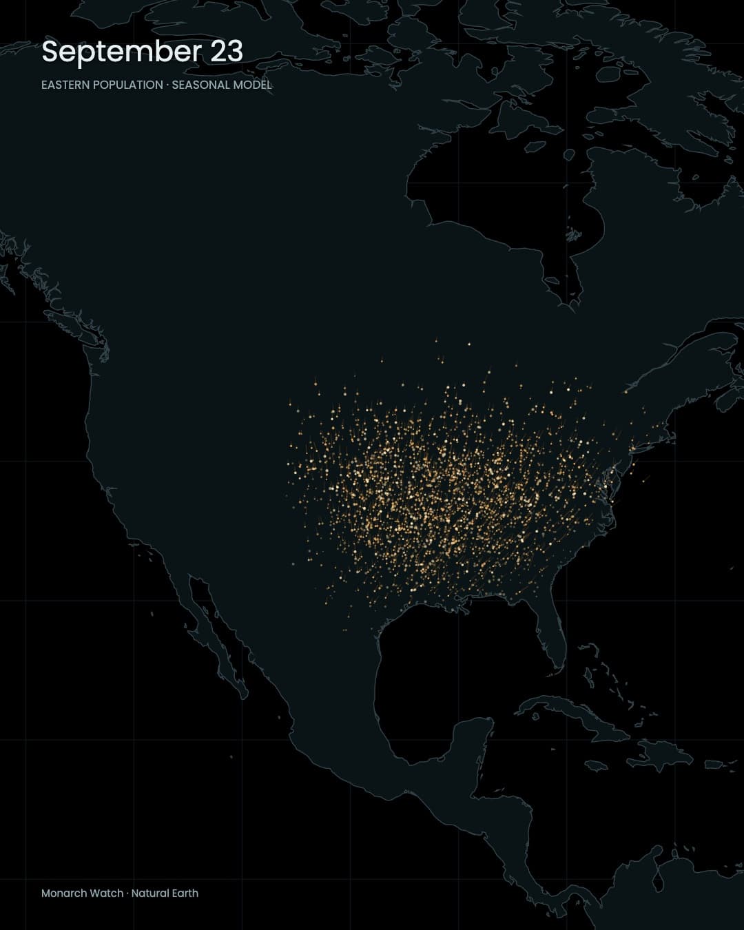
Shorter days and cooler conditions help prepare late-summer monarchs for migration. Unlike summer adults, these butterflies delay reproduction and accumulate energy for travel and winter. Feeding places along the way therefore belong to the journey as much as its destination does.[2]The animation uses Monarch Watch’s latitude-based timing guidance. Departure dates and progress vary, so the particles do not move as one rigid front. September leaves a broad spread across the continent. October and November draw that spread toward Mexico. The calendar gives the map a direction.[1]
![September 23 in the seasonal model. These paths illustrate timing and direction; they are not continuously tracked individuals.[1]](/images/articles/monarch-forests/feed-180.jpg)
September 23 in the seasonal model. These paths illustrate timing and direction; they are not continuously tracked individuals.[1]
A small destination with a continental hinterland
The winter destination lies in Mexico’s central highlands, roughly 100 km west and northwest of Mexico City, across Michoacán and the State of Mexico. The Monarch Butterfly Biosphere Reserve protects about 56,000 hectares of mountain habitat. Dense winter colonies occupy small parts of this much larger protected landscape.[6]![El Rosario wintering forest, Michoacán, Mexico, January 3, 2009. Photograph: hspauldi / CC BY-SA 2.0. Resized for display.[8][9]](/images/articles/monarch-forests/forest.jpg)
El Rosario wintering forest, Michoacán, Mexico, January 3, 2009. Photograph: hspauldi / CC BY-SA 2.0. Resized for display.[8][9]
At around 3,000 m elevation, cool conditions and the forest’s shelter help butterflies overwinter. Oyamel firs moderate wind and cold. The endpoint of a continental journey is a living mountain forest.[7]
![Monarchs on oyamel fir at Piedra Herrada, Valle de Bravo, State of Mexico, February 15, 2023. Photograph: Charles J. Sharp / CC BY-SA 4.0. Resized for display.[10][11]](/images/articles/monarch-forests/colony.jpg)
Monarchs on oyamel fir at Piedra Herrada, Valle de Bravo, State of Mexico, February 15, 2023. Photograph: Charles J. Sharp / CC BY-SA 4.0. Resized for display.[10][11]
Watch the changing shape of the distribution rather than count the lights. A broad field slowly gathers into a small area. That contraction is the central visual idea: the final cluster carries the geography of the continent behind it. Looking backward from the destination brings gardens, feeding places and distant summer habitat into the same frame.
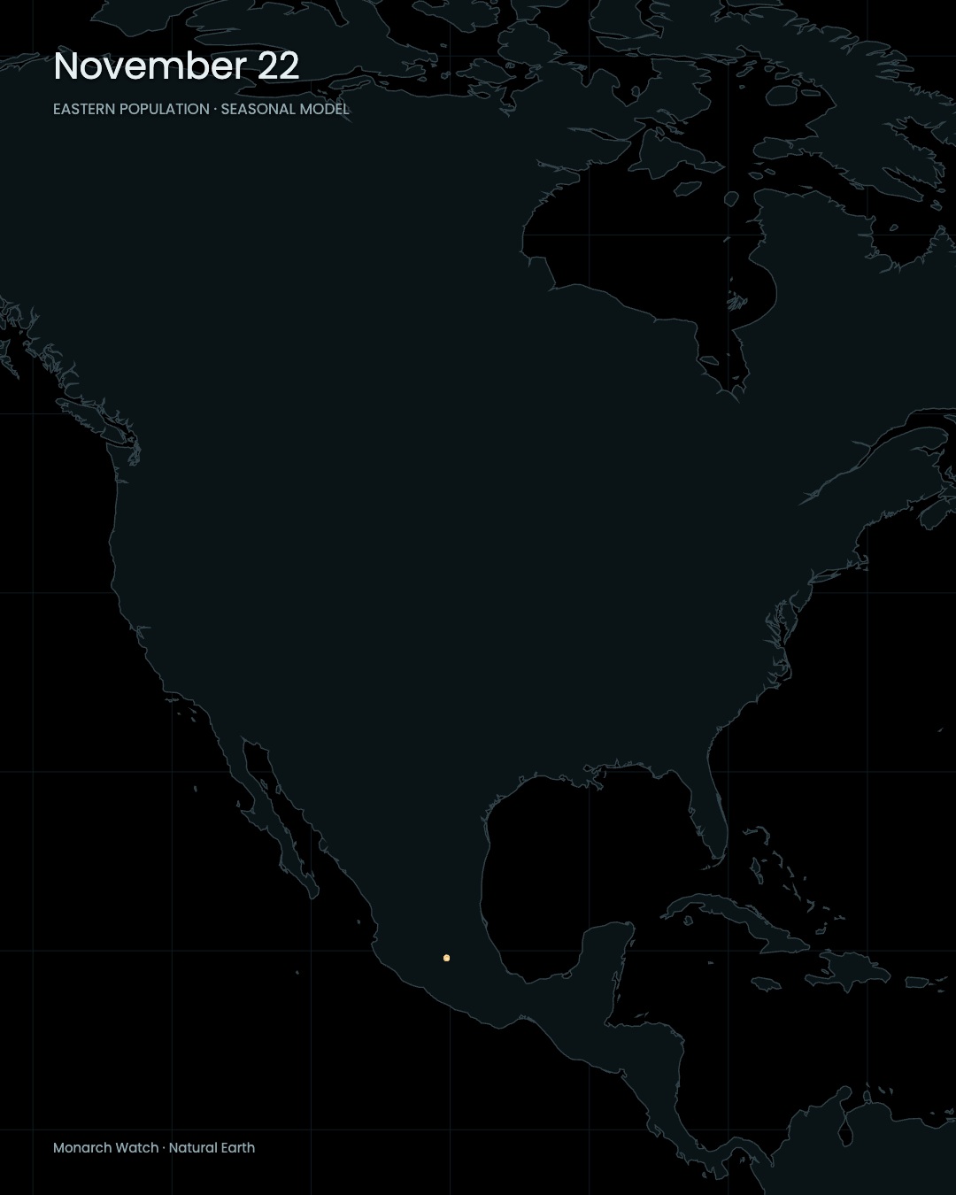
November: an approximate central-Mexican wintering region, not mapped boundaries of individual colonies.
Note · データと表現 / Data & method This is a seasonal model, not a particular year’s observations. Particle origins, routes, speeds and counts are illustrative. The destination is approximate, and western populations are excluded from the Mexican convergence. The basemap is Natural Earth.[1][2][4]
Sources
Author
SORAH Editorial
October 3, 2026



_on_Oyamel_fir_(Abies_religiosa)_Piedra_Herrada.jpg)