Published on 27/September/2026 · Nature
Kamchatka: a magnitude-8.8 earthquake and an eruption after nearly 500 years.
By SORAH Editorial
A giant earthquake struck offshore Kamchatka on 30 July 2025. Days later, Krasheninnikov erupted. Ground deformation detected between the two events offers a clue to their possible connection.
A vast fault moved beneath the ocean. Days later, a long-quiet volcano began releasing lava. The events in Kamchatka in summer 2025 are linked by more than a short interval: satellite measurements captured a change between them. Did the earthquake help trigger the eruption? [12][17]
The magnitude-8.8 earthquake that put the Pacific on alert
On 30 July 2025, a magnitude-8.8 earthquake struck offshore Russia’s Kamchatka Peninsula. USGS places it joint sixth among earthquakes recorded by modern seismic instruments. It occurred near a subduction plate boundary, moved the seafloor vertically and prompted tsunami watches and warnings around the Pacific. [17]This is a region where stress accumulates along a plate boundary and magma feeds volcanoes. Soon after a major rupture offshore, Krasheninnikov experienced its first eruption in nearly five centuries. The question is how the volcanic system responded to that disturbance. [13][16][17]
Note · Dates The earthquake occurred on 30 July 2025 in local time, but on 29 July in US Eastern time. Both dates appear in reports of the same event. [17]
On 3 August, lava began to emerge
NASA, citing the Kamchatkan Volcanic Eruption Response Team, reports that lava and ash began emerging from Krasheninnikov on the morning of 3 August. NASA describes this as its first eruption in nearly 500 years. [12][13]A crucial observation preceded the eruption. Satellite radar detected ground deformation after the earthquake but before the volcano erupted. JPL scientist Paul Lundgren interpreted it as possible evidence of magma intruding toward the surface, and considered the eruption to have been triggered by the magnitude-8.8 event. [12]
That intervening deformation gives researchers something to investigate beyond the timing alone: a recorded response at the volcano during the days separating the earthquake from the eruption.
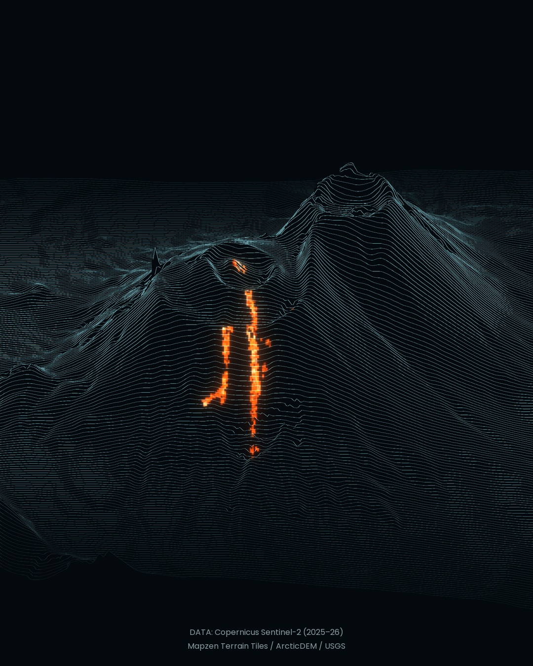
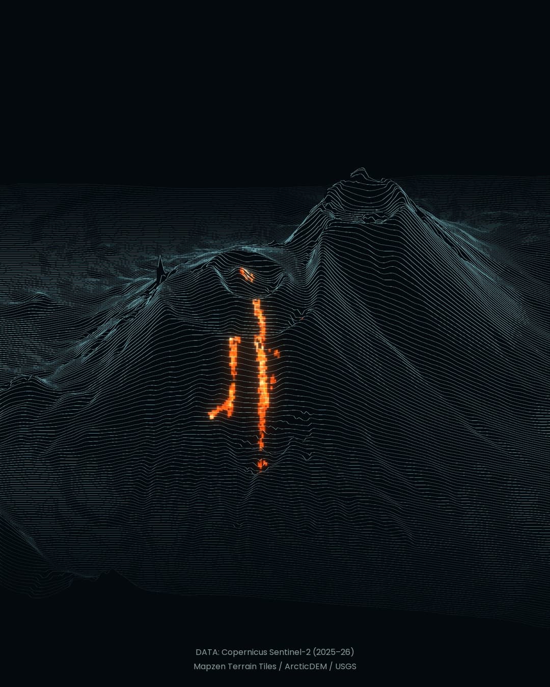
Observation: 4 August 2026. Sentinel-2 thermal indicator over terrain profiles. Orange texture and glow are a visual treatment. [4][8][9]
Note · Observation and interpretation Ground deformation was observed. Magma intrusion and earthquake triggering are interpretations of the evidence. The sequence alone does not establish causation. SORAH’s film does not depict this pre-eruption deformation or underground magma. [12]
When can shaking trigger an eruption?
A large earthquake does not automatically set off nearby volcanoes. USGS explains that triggering requires a system already poised to erupt, with sufficient eruptible magma and substantial pressure in its storage region. The condition of that system matters. [15]Under those conditions, an earthquake may cause dissolved gases to separate from the magma, increasing pressure and potentially leading to an eruption. Existing magma conditions and an external disturbance can interact. [15]
How much of that mechanism operated at Krasheninnikov still has to be established from evidence. The observed deformation offers a way to investigate its response. Alongside the extraordinary interval since its previous eruption, the few days between the earthquake and renewed activity deserve close attention.
Following the eruption through the next year
The observations continue after the opening event. SORAH’s film places a thermal indicator from five Sentinel-2 observations, between September 2025 and September 2026, onto the mountain’s slopes. Shortwave-infrared measurements locate the thermal responses detected on those dates. [8][9][10]A separate NISAR sequence released by NASA in September 2026 uses 17 radar images from December 2025 to August 2026. It follows lava filling a crater and spreading beyond it: evidence that the eruption continued to alter the surface after its first day. [13]
Note · Reading the film SORAH uses fixed terrain. Orange texture, bloom and flicker are artistic, not measurements of temperature, flow speed or elevation change. Dates: 25 and 30 September 2025; 4 and 16 August and 10 September 2026. Each appears for 3.6 seconds, despite unequal gaps including roughly ten months. No change is interpolated between observations. [4][8][9]
The magnitude-8.8 earthquake and the eruption after nearly five centuries form a specific scientific question. How did this volcano respond after the offshore rupture? Deformation before the eruption, then heat and spreading lava afterward, provide distinct pieces of that record.
Krasheninnikov has left more than dramatic images of a long-quiet mountain erupting. It offers observations against which to test how a giant earthquake can affect a volcanic system already capable of eruption.
About the data
Visualization: Sentinel-2 B11/B12 shortwave-infrared measurements (20 m), positive NHI_SWIR, screened for cloud, snow and other obscuring conditions. Dates: 25 and 30 September 2025; 4 and 16 August and 10 September 2026. Fixed Mapzen Terrain Tiles model, 2.2× vertical exaggeration. Contains modified Copernicus Sentinel data (2025–2026). Terrain sources: ArcticDEM, SRTM and GMTED / USGS. Full calibration, selection and attribution details are in data-check.json in the project download.Sources
- NASA SVS — NISARが捉えたクラシェニンニコフ火山(2026-09-24)
- NASA — Images and Media Usage Guidelines
- NASA — NISAR mission
- Mapzen Terrain Tiles — AWS Open Data registry
- Tilezen/Joerd — terrain sources and provenance
- Tilezen/Joerd — attribution and licensing
- ASF — NISAR data access and Earthdata Login
- Sentinel-2 L1C — Earth Search / Copernicusデータ
- Marchese et al. — NHI: A New Index for Detecting Volcanic Thermal Anomalies (2019)
- NHI algorithm — 開発者による数式・適用範囲
- Sentinel-2 L2A — Scene Classificationを含む公開データ
- NASA Earth Observatory — Krasheninnikova Remains Restless(2025-11-20)
- NASA/JPL — US-India Satellite Captures Time-lapse Video of Volcanic Eruption(2026-09-24)
- Copernicus Data Space — Sentinel-2 mission and open data
- USGS — Can earthquakes trigger volcanic eruptions?
- USGS — Introduction to Subduction Zones: Amazing Events in Subduction Zones
- USGS — M8.8 Kamchatka earthquake: event summary and tsunami implications (2025)
Author
SORAH Editorial
September 27, 2026