Published on 30/September/2026 · Water
The Kuroshio’s long meander comes to an end.
By SORAH Editorial
A large detour persisted from August 2017 to April 2025. Follow its changing shape through 97 monthly current fields.
A large detour persisted from August 2017 to April 2025. Follow its changing shape through 97 monthly current fields.
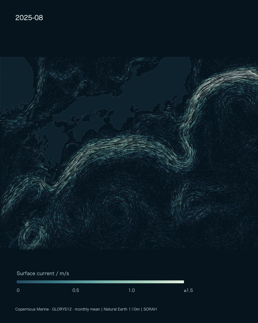
South of Japan, luminous strands of current reach offshore, curve around and turn east again. The Kuroshio’s large meander began in 2017 and persisted through years of changing shapes. In 2025, the broad detour finally unwound.[1][3]
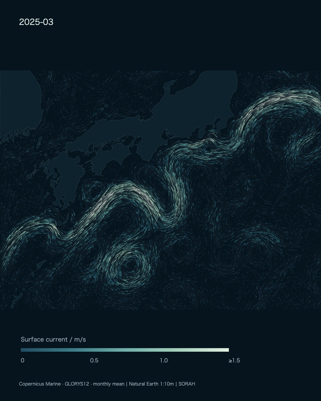
March 2025, before the large meander ended. Particle color represents monthly mean surface-current speed.[2]
Explore the Kuroshio in Data Scape
The Japan Meteorological Agency places the end in April 2025: seven years and nine months after August 2017, the longest episode in its record since 1965. The announcement came on 29 August 2025. The date of the change and the date of its confirmation were not the same.[1]
Persistence did not mean a fixed shape
JMA identifies the large-meander path by sustained separation from Cape Shionomisaki and a pronounced excursion south of 32°N off the Tokai region. Keeping Japan’s silhouette quiet but precise makes the distance between the coast and the current easier to see.[1]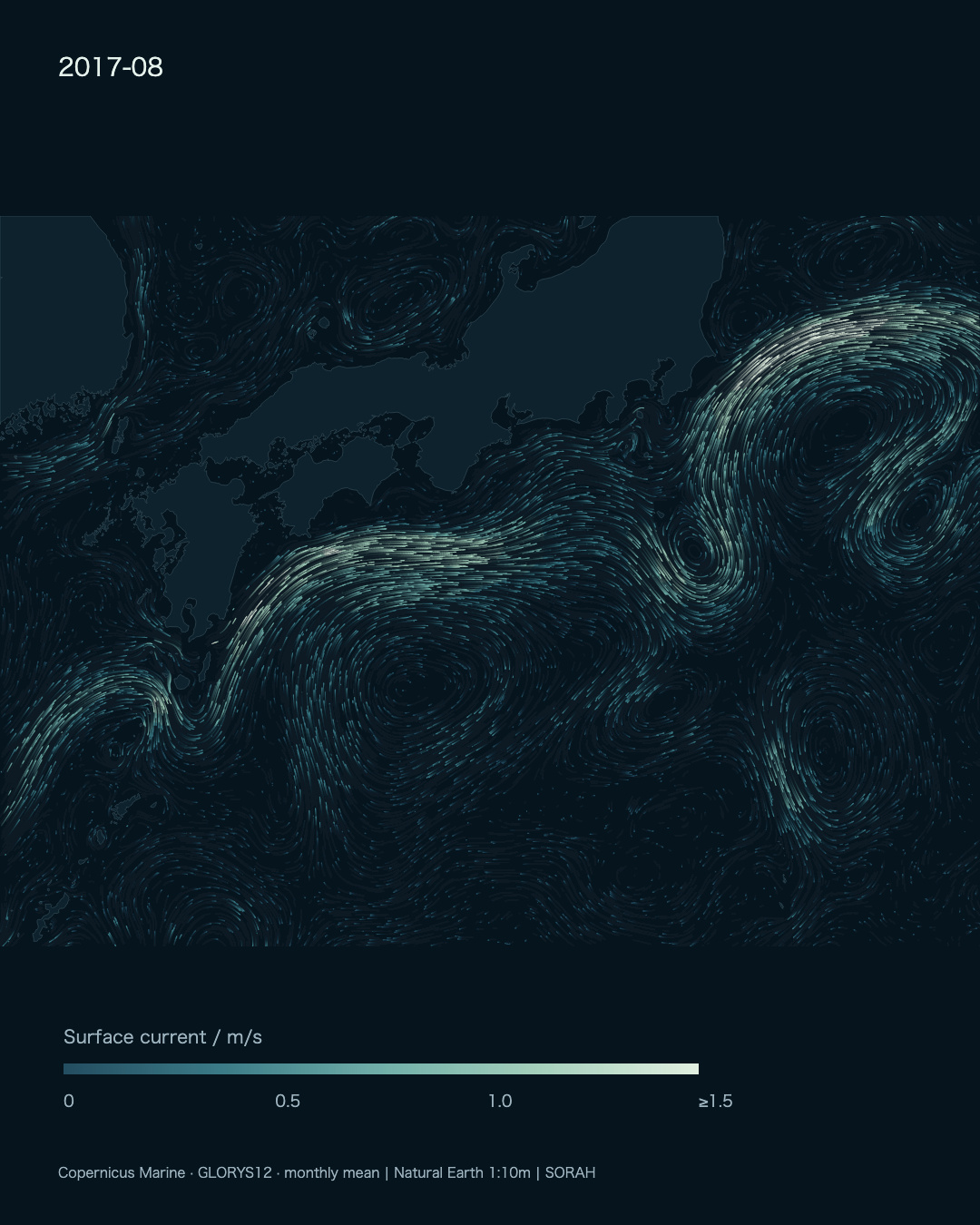
August 2017, the month the episode began. Geographic extent and speed scale remain fixed throughout the sequence.[1][2]
The film contains bends that tighten and relax, and surrounding eddies that change position. JMA’s history records a temporary contraction in 2020 followed by a return to the large-meander path. The episode was therefore treated as continuous.[3]
Recognizing an ending takes time
In 2025, a temporary contraction in February preceded a sustained contraction from late April. JMA reported signs of an ending in May and later confirmed April as the endpoint. A single narrow-looking frame would not establish that conclusion.[1][3]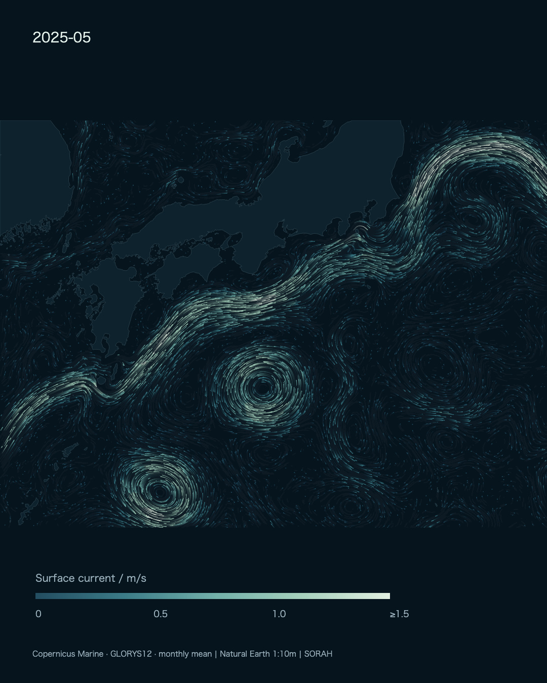
May 2025, after the endpoint identified by JMA. The image shows monthly mean surface currents.[1][2]
Current remains visible in the final scene. What ended was the large meander, not the Kuroshio. Non-large-meander paths can run closer to shore or farther offshore, so an ending does not mean that the subsequent route becomes permanently fixed.[3]
A route with consequences
The path matters to shipping, fishing grounds and coastal ocean conditions.[1] To see those relationships begin, follow a bright strand and then look back at the shore. The same flow pattern can be read as a shape in the ocean or as changing conditions beside a familiar coast.This current map cannot directly supply a catch forecast or a voyage time. Those questions require additional observations. It provides the spatial context in which such changes can be investigated, without assigning every local outcome to the meander.
Ninety-seven months in one frame
The field comes from Copernicus Marine’s GLORYS12 reanalysis, which combines an ocean model with observations. We use monthly mean surface currents from August 2017 through August 2025, including the months after the meander ended.[2]The timeline slows in 2025 and holds the final current field for seven seconds. That pause gives the altered route time to register. Japan stays in place; the water continues to move.
Note · Data and particle motion Depth: 0.494 m; domain: 127–146°E, 26–38°N. The approximately 1/12° source grid is sampled every 1/6° for rendering. Speed colors saturate at 1.5 m/s. Particles follow monthly vector fields interpolated between months; their accelerated movement is not an observed water-parcel trajectory. The 49.6-second film contains 97 months, a longer interval than the seven-year-nine-month meander itself.[1][2]
Sources
Author
SORAH Editorial
September 30, 2026